


The network tool allows a shapefile of points to be used as stops when calculating routes.
- Load a shapefile of points into the gvSIG View.
- Select Manage stops from the Network menu.
- Click the Load stops button.
- This brings up a window from which the point layer containing stops can be selected.
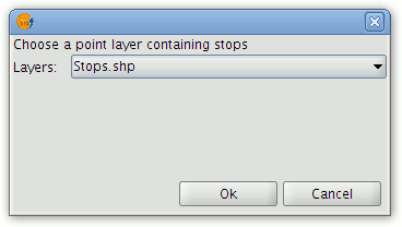
Choosing a layer to import as stops
- In the drop-down list select the point layer to be used. Only point layers loaded into the ToC of the View will be available for selection.
- Click the OK button.
- The points that have been loaded can now be used as stops when calculating routes.
Note
Although the stops can be saved in SHP, DXF or PostGIS format, when loading stops only point layers are accepted (not multigeometry layers).


